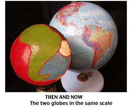
This video shows that our continents are pieces of a three-dimensional jigsaw puzzle and can perfectly cover a smaller globe. This result is not a coincidence and proves that the Earth has changed its size. In addition, the smaller globe shows that the relative positions of today’s continents and their orientation changed as they moved from their original positions.
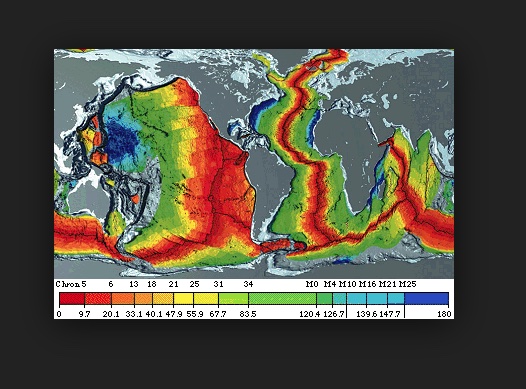
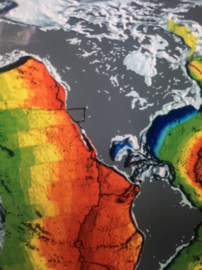
The painting “Titans Pie” shows four Titans molding the Earth. In fact, they had been working for billions of years. As can be seen, the Earth was still an endless ocean. However, the ocean floor was a jigsaw puzzle of faults and volcanic activity continents. But in this maze of lines, we can recognize the continents. The Earth is expanding, and the continents are slowly separating. They will rise above the ocean as it sinks into the spaces made as they move apart.
Titan's Pi

Building A Model Of The Past
Making the model did not change the outline of the continents or significant islands. First, of course, tracings were made of continents that included continental shelves. Next, these tracings were then applied manually to the small globe.
Photos Of The Steps In Building the Model
The images read vertically, first show a continent on the globe. The second image below shows the completed tracing of the continent. Beneath this image is the transfer of the tracing to the more miniature globe. The bottom photo shows the continent on the smaller Earth.
Note that the photos on the right-hand side omit the islands too small to be seen easily.

The Size Comparison

The two globes, shown together, show the size change with the Earth covered by the continents on the left and the Earth as it appears today on the right.
The Continent Are Always Moving
Geologists are aware of the slow movement of Earth’s continents across the globe. The expansion of Earth’s under the continents partially explains this movement. The continents are riding on a layer or sub-crust. This layer forms the ocean floor. Covered by sediment, it extends out from under the continents. Many locations show evidence of the ocean plates running under the continents.
Fault Lines On The West Coast


Notice the radial faults stepping evenly on both sides of the expansion fault

The major expansion fault line under the north American plate goes inland to Yellowstone.
The west coast of the US. is an excellent example to study. A fault line map of the ocean floor extending out into the Pacific Ocean shows two types of faults. There are radial fault lines and expansion fault lines in this layer of the Earth. The Earth’s rotation causes the radial fault lines. The Earth’s surface at the equator is traveling at 1000 miles an hour. At the poles, the Earth takes 24 hours to travel a few inches. It is the tension between these two speeds that causes the radial faults. These faults appear like steps radiating latitudinally from the expansion faults. The expansion faults generally run north-south in the middle latitudes. The radial faults extend equally on both sides of the expansion fault lines. The radial faults are the same length on each side of the expansion faults. These faults give the precise location of the expansion faults hidden under the continent. This method would indicate it goes into the South West, as far inland as Yellowstone.
Push And Pull Forces On The Continents
However, the expansion of the Earth only partially explains the movement of the continents. Earth’s magnetic forces pull the continents toward the poles, especially toward the North Pole. In addition, the rotational motion exerts a pull toward the equator. The smaller globe shows the west coast of North America next to the west coast of South America. The site of Lima, Peru, was once close to Los Angeles
The Explanation For The Dramatic Position-Shift.
The continental landmasses cluster together in an incrementally tighter mass close to the North pole. Their weight put the Earth’s crust increasingly out of balance. Centrifugal force pulls the continental masses towards the equator. At the same time, the influence of gravity depresses them into the sub crust, plus the magnetic pull holds the continental masses in a relatively stable position. The dis-equilibrium caused by the increasing clustering reached a critical point. The centrifugal force exerted sufficient power on the continental masses to pull them out of the depression in the sub crust towards the equator. This movement happens suddenly and with great speed.
New Positions
The continents would have moved into new positions on the globe in an attempt to regain equilibrium. The friction of this rapid movement would have resulted in liquifying the rock between the continental masses and the sub or ocean plates. The two geologists, Trond Torsvik and Bernard Steinberg, discovered vast formations, thousands of square miles, of pillow lava on the ocean floor that formed simultaneously. The rapid movement of continental masses across the ocean floor would explain this rock formation.
The smaller globe shows the west coast of North America next to the west coast of South America. Thus, for example, the site of Lima, Peru, was once close to Los Angeles.
New Ocean Floor
The liquefaction of the rock between the continents and the sub or ocean plates would reset the time clock, as measured through radioactive decay in the lava, back to zero. The repeated sliding of the continental masses would explain why the oldest part of the ocean floor is only 450 million years old while the continents have much older rock.
New Climates
The continents would have moved thousands of miles in these significant adjustments. This movement would explain the dramatic climate changes that happened in Earth’s past.
New Mountains
The resistance caused by this motion would have crumpled the leading edge of the continents. Forces of this magnitude created lines of mountains on the leading edge of the continents. These mountain chains would have risen overnight and would explain the large bands of metamorphic rock that exist in the areas of continental upheavals. However, if one landmass collided with another, one would ride up on top of the other. These collisions locked continents together to form a new landmass, only to be broken into smaller landmasses as the underlying sub crust expanded.
Major readjustment of the continents has happened many times. Older mountain chains indicate the direction of older adjustment of Earth’s equilibrium. As the Earth grew and the space between the continents expanded, the readjustments would have become more dramatic, especially in the last billion or so years.
Great Dyings
Major readjustment of the Earth’s crust would have caused violent volcanic activity. In addition, the force and speed of the readjustment would have caused an Armageddon-like scenario causing the release of vast quantities of iridium from the Earth’s interior. These readjustments would explain some of the Great Dyings in Earth’s history.
When the Earth was smaller, water would have covered the planet. The ocean would have been continuous and deep. The continents moved apart, and water would have filled the widening voids between the continents. As a result, the ocean above the continents became shallower, giving animal and plant life the environment to flourish, increasing in scale and diversity.
.